
Seawall planning in Bethune Beach & Silver Sands
Check Bethune Beach and Silver Sands seawall planning with county jurisdiction, coastal study context, walkover records and dune restoration questions.
Describe your project on this page ↓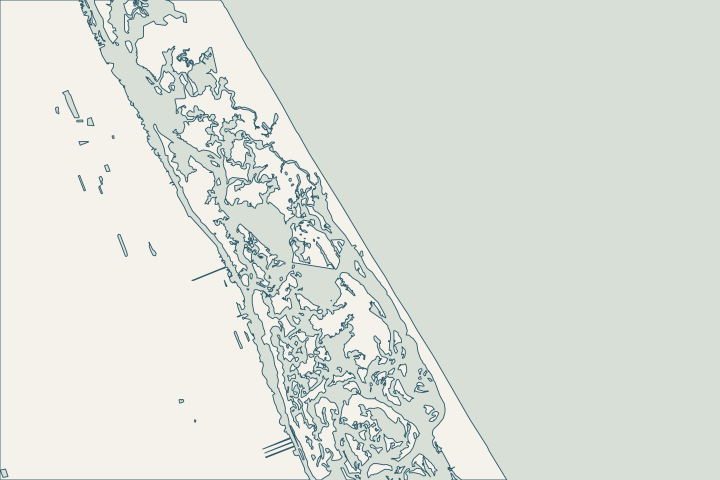
At a glance
- Verify the unincorporated boundary for Bethune Beach or Silver Sands.
- Identify ownership of any affected walkover or public access.
- Match the environmental inquiry to Atlantic or lagoon frontage.
Get to know your waterfront
South of the city beach reaches, Volusia’s coastal study combines Silver Sands and Bethune Beach into a separate analysis area. The county identifies Bethune Beach as unincorporated, and its public records describe Kingfish and Mary McLeod Bethune access repairs. A New Smyrna mailing address does not settle the permit authority. Confirm the parcel and its Atlantic or lagoon-side frontage before deciding what kind of shoreline review to request.
Volusia County Habitat Conservation Plan · Volusia beach feasibility assessment posters · Volusia beach-access repairs, May 10, 2024 · Volusia coastal park locations · New Smyrna Beach Building & Inspections · Volusia manatee plan: Halifax/Indian River zones
Begin with the parcel and shoreline setting
Use this sequence to prepare the property file and resolve the local questions.
Verify the unincorporated boundary
Check the county record rather than relying on the postal city.
Volusia County Habitat Conservation Plan · New Smyrna Beach Building & Inspections
Identify affected access
Name any walkover or public facility beside the project and clarify ownership.
Volusia beach-access repairs, May 10, 2024 · Volusia coastal park locations
Ask the matching environmental questions
Use coastal review for Atlantic armoring and facility/habitat review for lagoon-side work.
Volusia County Beach and Dune Permit · Volusia manatee plan: Halifax/Indian River zones
Keep oceanfront armoring and lagoon-side work distinct
For an Atlantic parcel, ask about the dune, beach profile, wall ends and walkover interface. For a lagoon-side project, describe the existing habitat and any dock/slip change to the environmental reviewer. The manatee plan’s Mosquito Lagoon zone description is a planning reference, not a permit for construction.
The county’s 2024 walkover announcement records completed work at named public accesses. Verify present access separately and obtain permission for any proposed equipment route.
Local records to bring into the conversation
- Volusia’s coastline map identifies Ormond-by-the-Sea, Wilbur-by-the-Sea and Bethune Beach as unincorporated.
- The study combines Silver Sands and Bethune Beach from R-185 to T-208.
- Volusia reported reopening Kingfish and Mary McLeod Bethune Beach ADA walkovers in unincorporated Bethune Beach after Hurricane Dorian mitigation work.
- Volusia locates Mary McLeod Bethune Park at 6656 S. Atlantic Avenue.
- New Smyrna’s department page states that unincorporated properties returned to Volusia development services on July 1, 2022.
- The plan describes Zone 7 from Marker 65 through Mosquito Lagoon to the Volusia/Brevard line, including Oak Hill and the aquatic preserve.
Volusia County Habitat Conservation Plan · Volusia beach feasibility assessment posters · Volusia beach-access repairs, May 10, 2024 · Volusia coastal park locations · New Smyrna Beach Building & Inspections · Volusia manatee plan: Halifax/Indian River zones
Choose the inquiry by shoreline, then by scope
After confirming the parcel authority, prepare separate questions for Atlantic armoring or lagoon-side shoreline work.
- On the Atlantic, locate the dune, wall ends and walkover.
- On the lagoon, identify habitat and any dock or slip changes.
- For either side, show the equipment route and restoration limits.
Public Kingfish or Bethune access records help identify nearby facilities. Ask about present permissions before including one in the contractor’s access plan.
Volusia beach-access repairs, May 10, 2024 · Volusia County Beach and Dune Permit · Volusia manatee plan: Halifax/Indian River zones
Find the relevant permits and records
| Starting point | What to resolve | Prepare and look up |
|---|---|---|
Volusia Permit Center | Building permits for unincorporated property. | Confirm the parcel; 386-736-5929. Use Connect Live for the county record. |
Volusia Environmental Management | Beach and Dune review in addition to other approvals. | Include dunes, armoring, access and walkovers; specialist: 386-238-4773. |
Florida DEP coastal program | CCCL and coastal armoring questions. | Volusia CCCL: 850-245-7680. Statewide armoring: 850-245-8419. |
DEP / SJRWMD; federal review as applicable | Environmental authorization, exemption verification and submerged-lands questions. | Provide the same existing/proposed alignment, backfill and related dock scope to each reviewer. |
What could the work cost?
Ask for allowances covering the actual frontage, environmental review, equipment access and restoration. A coastal study metric or public access project does not establish the cost for your wall.
Start with published Florida price ranges, then refine the budget with a written quote for your property.
Compare quotes and plan a budget →Prepare your Bethune Beach & Silver Sands project notes
Record the address, water frontage, visible concern and any decision deadline. Add existing plans and photographs when available.
You don’t need to know the repair yet. Start with what you’ve noticed.
Bethune Beach & Silver Sands project questions
Does a New Smyrna address mean the city handles the permit?
Not necessarily. The city’s current department page sends unincorporated properties to Volusia, and the county identifies Bethune Beach as unincorporated.
New Smyrna Beach Building & Inspections · Volusia County Habitat Conservation Plan
Can I use the county’s combined Silver Sands/Bethune study reach as my property boundary?
No. R-185 to T-208 is regional study geography. Use the parcel record, a current survey and the actual permit conditions for construction.
Keep planning
Nearby waterfront guides
Show sourcesHide sources
- Volusia County Habitat Conservation PlanSource reviewed 2026-10-25
- Volusia beach feasibility assessment postersSource reviewed 2026-10-25
- Volusia beach-access repairs, May 10, 2024Source reviewed 2026-10-25
- Volusia coastal park locationsSource reviewed 2026-10-25
- New Smyrna Beach Building & InspectionsSource reviewed 2026-10-25
- Volusia manatee plan: Halifax/Indian River zonesSource reviewed 2026-10-25
- Volusia County Beach and Dune PermitSource reviewed 2026-10-25
- Volusia Building and Code AdministrationSource reviewed 2026-10-25
- DEP CCCL managersSource reviewed 2026-10-25
- DEP ERP e-PermittingSource reviewed 2026-10-25
- St. Johns River Water Management District permittingSource reviewed 2026-10-25