
Seawall repair in Ponce Inlet
Plan Ponce Inlet seawall work by identifying ocean, inlet or river frontage. Use town permit records, county beach review and dock-compliance questions.
Describe your project on this page ↓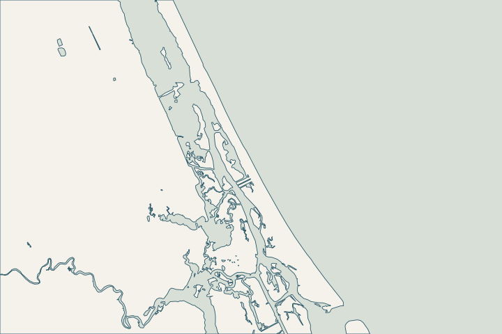
At a glance
- State whether the property faces the ocean, inlet or river.
- Retrieve the town’s approved plans and closeout records.
- Ask which county and state reviews apply to the complete proposal.
Get to know your waterfront
A Ponce Inlet project should begin by naming the water frontage: Atlantic beach, inlet-side or river-side. The town provides its own planning and development review and public permit search. County coastal and dock-related requirements can sit alongside the town permit. Public places such as Lighthouse Point Park are useful location references, but their access and shoreline infrastructure are separate from a private property’s construction rights.
Ponce Inlet Planning & Development · Ponce Inlet permit search · Volusia beach feasibility assessment posters · Volusia coastal park locations · Volusia County Beach and Dune Permit · Volusia single-family dock permitting
Make exposure and access part of the first design discussion
Give the engineer the actual frontage, prior plans and survey. Ask which site observations are needed to evaluate erosion, wave effects, wall support and any dock connection. An inlet-side view and an Atlantic wall should not be priced from the same generic material-only description.
Search town records for work class, permit status and approved revisions. For a beachfront parcel, identify the dune and access scope before asking DEP and Volusia which approvals apply.
Local records to bring into the conversation
- Ponce Inlet Planning & Development lists 386-236-2183 and advises checking permit requirements before construction.
- Ponce Inlet’s public portal offers permit searches by address, permit number, work class and status.
- The study’s Ponce Inlet reach runs from R-128 to R-148.
- Volusia locates Lighthouse Point Park at 5000 S. Atlantic Avenue in Ponce Inlet.
- Projects touching the sand or immediately next to the beach may require a County Beach and Dune Permit in addition to state and municipal approvals.
- For a single-family dock inside a city, the city handles the building permit and Volusia separately asks for its mitigation checklist, dock/slip site plan and applicable fee.
Ponce Inlet Planning & Development · Ponce Inlet permit search · Volusia beach feasibility assessment posters · Volusia coastal park locations · Volusia County Beach and Dune Permit · Volusia single-family dock permitting
Describe the frontage before requesting equipment access
Mark whether the site faces the inlet, river or Atlantic. Add the proposed land or marine approach and any nearby public facility.
- Who controls the proposed staging area?
- Which existing docks or utilities obstruct the route?
- What needs restoring after equipment leaves?
Give the town and environmental reviewers the same scope. Proximity to Lighthouse Point Park may help locate the property, but it does not grant access through the park for construction.
Ponce Inlet Planning & Development · Volusia coastal park locations
Find the relevant permits and records
| Starting point | What to resolve | Prepare and look up |
|---|---|---|
Town of Ponce Inlet Planning & Development | Town permit, zoning and record questions. | 386-236-2183; use the town-linked public permit search. |
DEP / SJRWMD; federal review as applicable | Environmental authorization, exemption verification and submerged-lands questions. | Provide the same existing/proposed alignment, backfill and related dock scope to each reviewer. |
Volusia Environmental Management | Beach and Dune review in addition to other approvals. | Include dunes, armoring, access and walkovers; specialist: 386-238-4773. |
Florida DEP coastal program | CCCL and coastal armoring questions. | Volusia CCCL: 850-245-7680. Statewide armoring: 850-245-8419. |
Volusia Environmental Management | Dock/slip manatee compliance where applicable. | Confirm facility type, existing slips and the current mitigation amount; a compliance letter does not replace other permits. |
What could the work cost?
Ask for the mobilization method, working area, temporary protection and restoration in writing. Do not treat proximity to a public park or boat facility as approved equipment access.
Start with published Florida price ranges, then refine the budget with a written quote for your property.
Compare quotes and plan a budget →Name the frontage before collecting bids
Use this sequence to prepare the property file and resolve the local questions.
Write a one-paragraph scope
State the water side, wall length, change in alignment/elevation and associated dock or dune work.
Retrieve the town record
Search the address and permit number; request missing plans and closeout evidence.
Resolve parallel review
Ask which county and state reviews apply to the same complete scope.
Volusia County Beach and Dune Permit · Volusia single-family dock permitting
Prepare your Ponce Inlet project notes
Record the address, water frontage, visible concern and any decision deadline. Add existing plans and photographs when available.
You don’t need to know the repair yet. Start with what you’ve noticed.
Ponce Inlet project questions
Is the county’s Ponce Inlet reach a legal property boundary?
No. R-128 to R-148 is the study’s regional reach. Use a property survey and the applicable permit records for construction decisions.
Do town permits replace dock manatee review?
Not automatically. Volusia’s dock guidance describes county compliance alongside city building permits. Ask about the proposed facility and slip arrangement.
Keep planning
Nearby waterfront guides
Show sourcesHide sources
- Ponce Inlet Planning & DevelopmentSource reviewed 2026-10-25
- Ponce Inlet permit searchSource reviewed 2026-10-25
- Volusia beach feasibility assessment postersSource reviewed 2026-10-25
- Volusia coastal park locationsSource reviewed 2026-10-25
- Volusia County Beach and Dune PermitSource reviewed 2026-10-25
- Volusia single-family dock permittingSource reviewed 2026-10-25
- DEP ERP e-PermittingSource reviewed 2026-10-25
- St. Johns River Water Management District permittingSource reviewed 2026-10-25
- DEP CCCL managersSource reviewed 2026-10-25
- Volusia Manatee Protection Plan 2022 addendumSource reviewed 2026-10-25